Industrial Facility Verification — When The 3D Model Stops Reflecting Reality
Client: Multinational Company
Industry: Industrial
Location:Scottish Industrial Facility
Our Experience
The Situation
As part of a major process upgrade involving installation of a system, Phase was commissioned to carry out a precision laser scan of the project envelope — capturing existing conditions inside, outside, and across the surrounding area. The scan was tied into survey control and delivered to the project designers as a verified point cloud database, alongside an interactive virtual tour allowing all parties to communicate around a shared visual reference of the site.
As construction progressed, a column clash was discovered during installation. With multiple parties involved — the designer delivering the package, civil and structural engineers and site staff contracted to the client — our client wanted a clear picture of where things stood before costs escalated further. Phase was asked to return to site, establish current conditions, and present the findings to the client and their engineers.
What Phase Established
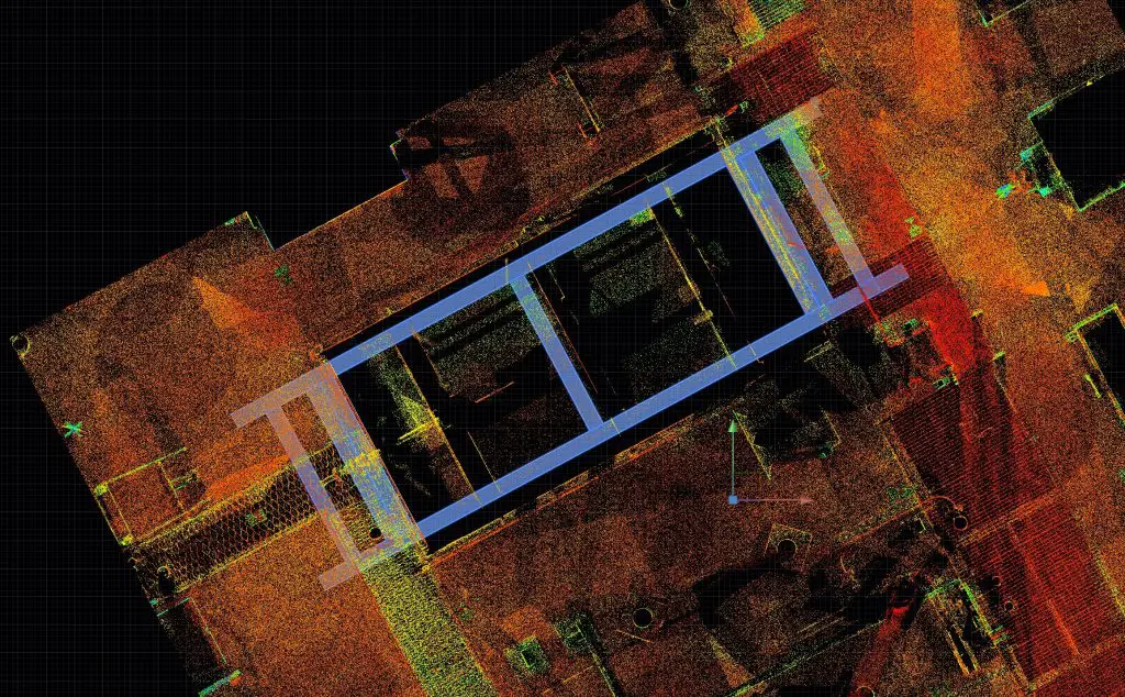
Phase returned to site and carried out an intermediate during-build scan — capturing the construction area as it stood at that point in time. The new point cloud was overlaid against the original Phase scan using the established survey control grid, immediately revealing what had changed, what had been relocated, and what was new.
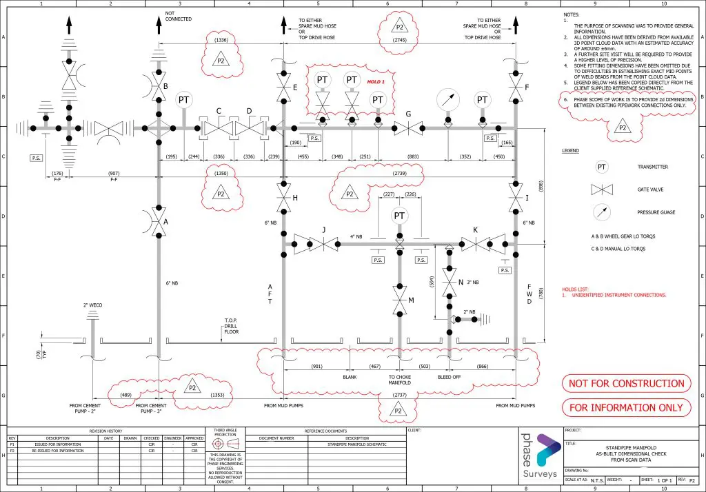
The designer’s Navisworks model was then moved into its correct position on the survey grid. With all three datasets aligned — original scan, intermediate scan, and designer’s model — a reliable clash check could be carried out. The investigation identified missing pipework from the original model used for design, columns in different positions to the design, and a new building to house an electrical panel adjacent to a transformer. Findings were presented to the client and their engineers, discussed openly, and resolved through agreement before installation continued.
The Consequence Addressed
Conflicts between a designer’s installation and existing or relocated infrastructure — discovered during construction — carry real cost consequences. The client’s priority was clarity: understand where things stood, resolve what needed resolving, and avoid further conflicts as installation continued. Phase provided that clarity by establishing what had actually been built, aligning the design model with verified physical conditions, and identifying every remaining conflict before work proceeded.
What Happened And Why It Mattered
Original Baseline & Virtual Tour
Phase carried out a precision laser scan of the area at the outset — internals, externals, and surrounding area — tied into survey control. The verified point cloud was delivered to the designers as their spatial reference for the project. An interactive virtual tour was produced alongside it, giving all parties a shared visual reference throughout design and construction.
Intermediate During-Build Scan
When conflicts began emerging during installation, Phase returned to site and carried out an intermediate scan — capturing mid-construction. The new point cloud was overlaid against the original using the Phase survey control grid, establishing exactly what had changed, what had been relocated, and what new elements existed. This intermediate scan was the foundation for everything that followed.
Model Aligned, Conflicts Identified
The designer had done an impressive job across a complex project. Phase moved the designer’s Navisworks model into its correct position on the survey grid.
With all three datasets aligned, the specific conflicts could be identified: missing key pipework, columns in different positions to the original design, and a new electrical panel building.
All findings were presented to the client and their engineers, acknowledged, and resolved. The point cloud — not the model — was the reference that made this possible.
Precision Baseline Survey
Area laser scanned internally, externally, and across surrounding area at project outset. Survey tied into control grid. Point cloud and virtual tour delivered to designers as verified spatial reference.
Construction Begins
Designer updates their model during the build. Multiple parties involved — designer, civil and structural engineers, site staff. A column clash is discovered during installation. Client needs clarity on where things stand.
Phase Returns To Site
Intermediate during-build scan carried out — capturing the build mid-construction. New point cloud overlaid against original using Phase survey control grid
What Had Changed — Established
Comparison of original and intermediate scans revealed what had been built, what had moved, and what was new — providing a verified picture of current site conditions.
Designer's Model Aligned
Designer’s Navisworks model moved into correct position on the survey grid. All three datasets aligned — original scan, intermediate scan, designer’s model — for the first time.
Findings Presented And Resolved
Missing pipework, relocated columns, and a new electrical panel building identified. Findings presented to the client and their engineers. All acknowledged and resolved before installation continued.
Related Work
Our Experience
The project in numbers
Site Visits
2
Baseline & Intermediate
Conflicts Identified
3
All resolved
Resolved
In Design
Not on site
Why It Mattered
Construction environments change constantly. Existing infrastructure gets relocated. New elements are added.
A design model updated during the build — without being checked against verified physical conditions — can drift from reality without anyone realising.
The intermediate scan Phase carried out re-established the verified spatial reference that made reliable checking possible — and prevented further conflicts from reaching site.
The Point Cloud Is The Truth
A well-produced 3D model is an impressive thing. But it is an interpretation of physical reality — not a record of it. The point cloud is the record. When decisions stop being checked against the point cloud and start being made solely from the model, the gap between design and reality grows — quietly, until it surfaces during installation.
Phase’s recommendation on every construction project is the same: refer back to the point cloud. Every time.
What Should Happen On Every Construction Project
The most effective approach to construction verification is progressive scanning throughout the build — capturing conditions at regular intervals, overlaying each scan against the last, and identifying conflicts while they are still resolvable in design. This produces a continuously updated as-built record that culminates in a final scan reflecting exactly what was built.
The result is a no-surprises as-built model — one that can be relied upon for operations, maintenance, and future modifications without question.
On this project Phase carried out a baseline and a single intermediate scan. The findings from that one intermediate scan justified the exercise entirely. On future projects, Phase recommends scanning continuously throughout the build.
The Result
Two site visits. Three conflicts identified. All resolved before installation continued. The client had the clarity they needed — and a clear understanding of the value of keeping the point cloud as the reference throughout construction.
Construction not matching what was designed?
If you need a clear picture of where a construction project stands — or want to maintain a verified as-built record throughout the build — a short conversation is often enough to establish whether Phase can help.